
The Thomsen – Which Way is North? by Ted Johnson
“We’re picking up a shit-load of ice, Ted”, our pilot Ross Peden shouted back over his shoulder. “I’m going to have to turn back to Inuvik.” It had been half an hour since our Twin Otter had left the Arctic Ocean coastline and droned out in dense cloud over the Beaufort Sea.

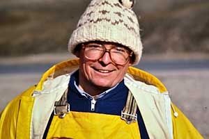
Peter. Craig, Denis, John and Ted Dockside in Inuvik
Six of us (Craig, Tim, Peter, John Godfrey, Denis Harvey and Ted) in bush seats down the port side wedged against half a ton of canoes, food and gear. Tim was our least enthusiastic passenger. He was suffering from a pinched nerve in his neck and would moan, head buried in his hands, with every loud thud as accumulated ice would sluff off the propellers and slam into the side of the plane. The wings were becoming visibly caked with white rime ice. It was summer in the Arctic Islands and time to go canoeing.
The Thomsen River rises in the centre of Banks Island at west end of the Arctic Archipelago, and wends a gentle serpentine course through a wide alluvial valley. There are only rapids and they’re all very easy. We know that now, but we didn’t in 1985 when we began planning this trip. As far as we could determine, no one had ever paddled it. Even the Inuit were unlikely to descend it by kayak; more likely they would have dog-sledded in search of muskoxen. The only southerner we could find who knew the topography of the interior of Banks Island was Tom Manning who gave us helpful advice. He had walked the length of the Island in 1953 doing reconnaissance for the Defense Research Board.

Thomsen River Plateau
This was to be our first sojourn into the Arctic Islands. We had done the major wild rivers of the arctic mainland, and were now looking further afield. The Thomsen – named for a lost member of Stephenson’s (1916) winter sled expedition – appeared to offer an opportunity to paddle to the Northwest Passage.
It was – and remains – quite unusual to operate a float plane in the Arctic Islands, but that is what we were attempting to do. There was no known flat spot for landing on wheels near the river. But maps and our photos revealed a widening in the river about a hundred miles upstream from the Passage.
In any event, we turned back from that first attempt to fly in because of poor weather. We hung around Inuvik for three or four days till pilot Ross announced better weather for a second try. After an ice-free flight, still in the perpetual cloud of an Arctic summer “low”, we broke out of the low overcast less than a hundred feet above the sea and landed on the salt water bay at Sachs Harbour, an Inuit community of two hundred, famous for its silver fox hunt.
Refuelling was done from drums on the rocky beach with help from local volunteers. One of them offered, “You not taking dogs? – You gonna die up there!” And with that, we were off on a hedge-hopping flight to the centre of the island at an altitude of what seemed like twenty metres. Our first glimpses disclosed endless emerald-green tundra punctuated by shattered rock, occasional muskoxen, and partially ice-covered tundra ponds. Finally, our pilot shouted back to us that the band of water to our left seemed to match up with the Thomsen River on his map. (This was, of course, before the advent of GPS). He circled for an eternity checking the intended landing area for underwater rocks, landed without event and was soon heeling the floats up on a gravel beach, The river here ran west to east before turning north for its long meandering run to the Passage at Bay.

Thomsen Arrival
Unloading took no time. Then that inevitable melancholy moment of intense loneliness when the plane is off and out of earshot and we are on our own. We got down to work immediately in reinstalling the seats and thwarts in the canoes and setting up camp in grey overcast with occasional light showers. Temperature a little above freezing – and the gift of utter silence. Well, utter silence until someone came up with something to argue about.
It didn’t take long. I think it was John Godfrey who was first to note that there was no current in the river. Well then, which way should we paddle in the morning? Someone – could have been me – was sure the plane had turned left after landing. That meant we had beached on the south bank, so downstream was to the right. “No no,” from another quarter; “The plane turned right so we’re on the north bank so we go left in the morning.”
The problem was compounded by the fact that there was no sun because of the heavy maritime Arctic overcast. Pretty soon, the party was split down the middle; three in the “go left” faction; three in the right. Voices rising, heels being further dug in. The issue was important because if the river remained slack, with no current for some distance, we could waste a lot of time paddling in the wrong direction. And we’d already lost several days with the weather delay in Inuvik.

Ted, Craig, & Peter – Happy Hour in the Cold
It was about then that Craig stood beside the kitchen canoe area tapping loudly on a cooking pot and announcing “happy hour”. He’d mixed up his daily concoction of overproof rum, powdered daiquiri mix and water. While drinks were being poured, one of us – could have been me – slipped into his tent to dig out his compass.
There’s a myth that the compass is unreliable in the High Arctic. That’s probably why none of us was carrying one. There are indeed areas where this is true, due to mineralization in the rock or anomalies in the earth’s magnetic field, but the interior of Banks Island is not one of them. The only problem there, at 75 degrees north latitude, was that in August 1985 the magnetic north pole was some 700 kilometres due east of us (it’s constantly on the move). So in other words, if you were standing in our campsite facing true north, your compass needle would point rock-solidly 90 degrees to your right.

Which Way is North?
Regrettably, as I faced the river, I found that my compass pointed rock-solidly to my left. This meant we were on the north bank. It meant that to do downstream, we should paddle to the left in the morning. And it meant that I belonged to the wrong faction.
Craig’s daiquiris are potent. Especially at the “welcome campfire” on the first night of a trip. And, they’re doubly so – no doubt in an effort to stimulate the milk of human kindness – when the group is riven by a dispute. So somewhere in the course of the ensuing boisterous conversation, with the group uncharacteristically and temporarily boiled, and without revealing my research involving my compass, I allowed as how I was sure the river flowed to the left, and that I’d always believed that. Couldn’t recall ever having suggested otherwise …
So the lefties prevailed four-to-two. The sun did not shine the following morning, but fairly soon after we set off, the river narrowed and we began to detect a bit of a current. We were paddling in the right direction and we were on our way to the Northwest Passage.
Ted Johnson
Thomsen River Team – August 1985

L-R: Tim Kotcheff, Peter Stollery, Ted Johnson, Craig Oliver, John Godfrey, Denis Harvey.
(Return to Thomsen River Page)